||| FROM CNN |||
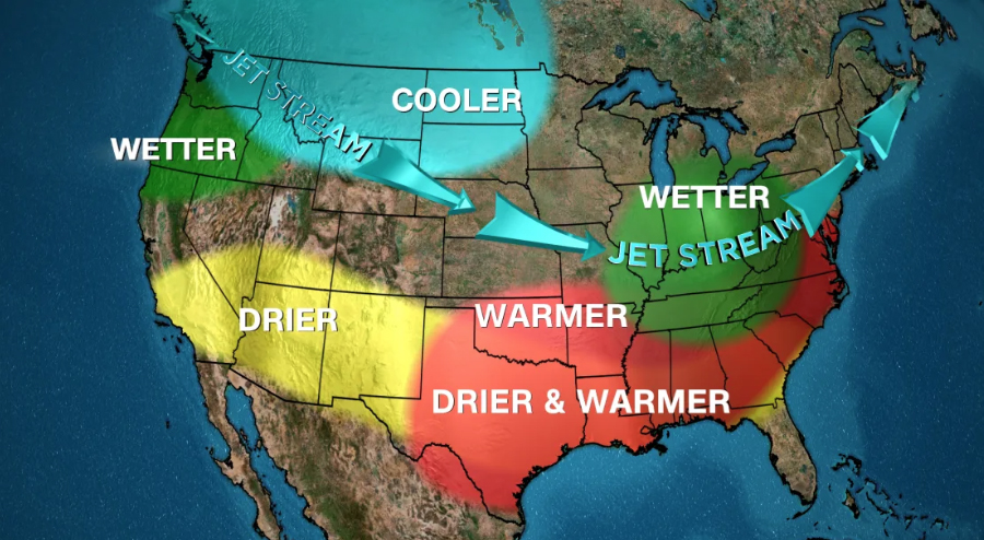
Fall is in full swing, but it’s not too soon to look ahead to winter, especially one that could feel considerably different than last year’s dominated by El Niño.
A weak La Niña is expected to develop ahead of the season and influence temperatures, precipitation, and by extension, even snow across the United States.
La Niña is a natural climate pattern that influences global weather marked by cooler than average ocean temperatures in the equatorial Pacific. The effects on weather are most pronounced during the winter months in the Northern Hemisphere and have a much weaker influence in the summer.
Last winter was the warmest on record for the Lower 48 because it was dominated by La Niña’s counterpart El Niño in a world also warming due to fossil fuel pollution.
The prolonged warmth prevented many heavy snow events in the Northeast and Midwest and created a winter snow drought measured in feet of missing snow.
La Niña isn’t here yet, but has a 60% chance of emerging through November, according to the Climate Prediction Center. Once it arrives, it’ll stick around all winter and likely persist into at least early spring of next year.

**If you are reading theOrcasonian for free, thank your fellow islanders. If you would like to support theOrcasonian CLICK HERE to set your modestly-priced, voluntary subscription. Otherwise, no worries; we’re happy to share with you.**