— from Salish Sea Pilot —
 Talking to cruisers from up and down the coast at the Vancouver Boat Show last week, we realized not everyone knows precisely what waters are included within the “Salish Sea.”
Of course, everyone knows the Salish Sea. They know the name was officially adopted in 2009 by the governments of British Columbia and Washington State to give a common name to the waters in and around the straits of Georgia and Juan de Fuca.
The name was first proposed in 1988 by marine biologist Bert Webber who saw a need for a single geographical term which recognized the shared water, air, wildlife and history on both sides of the international boundary. The designation also pays tribute to the Coast Salish people who have lived in the area for many generations before the first explorers arrived from Europe.
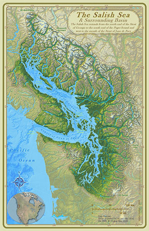
 The Salish Sea covers about 18,000 sq.km. (7,000 sq.miles) of saltwater, stretching from the northern reaches of the Discovery Islands to the southern tip of Puget Sound and west along Juan de Fuca Strait to the Pacific Ocean. About 60 percent of the sea area is in BC, 40 percent in the US.
The watershed includes some 110,000 sq.km (42,000 sq.miles) of territory, which the map on this page by cartographer Stefan Freelan so wonderfully portrays.
More than seven million people live within the drainage basin of the Salish Sea, which includes the cities of Seattle, Vancouver, Victoria, Olympia, Tacoma, Nanaimo, Bellingham, Everett, Port Townsend and Port Angeles.
As well, the sea is home to more than 200 species of fish, 100 species of birds, 20 marine mammals and 3,000 invertebrates.
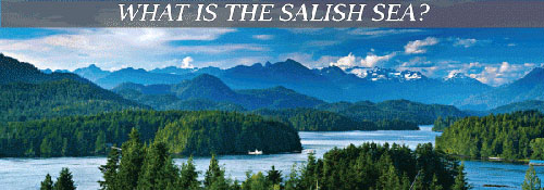
This all does not begin to express that the Salish Sea includes some of the most beautiful cruising areas in the world.
SOURCE: Salish Sea Pilot
**If you are reading theOrcasonian for free, thank your fellow islanders. If you would like to support theOrcasonian CLICK HERE to set your modestly-priced, voluntary subscription. Otherwise, no worries; we’re happy to share with you.**


That’s great that the Salish Sea encompasses the waters ‘in and around the straits of Georgia and Juan de Fuca’.
Any chance you could provide the latitude/longitude points the define the boundaries of the Salish Sea such that I could plot the Salish Sea on a chart?
So far no one has been able to do that, including the Friends of the San Juans. So I remain curious – where is the Salish Sea?
– rob
Hi Rob
Check out the details behind the map above at https://staff.wwu.edu/stefan/salish_sea.shtml. There is an interactive map linked from there that shows the approximate boundary of the surrounding basin. The Salish Sea is encompassed within that region.