
— from National Weather Service —
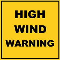
…HIGH WIND WARNING REMAINS IN EFFECT FROM 7 AM TO 7 PM PST THURSDAY… * WIND…SOUTH TO SOUTHEAST WIND 25 TO 40 MPH WITH GUSTS UP TO 60 MPH. * SOME AFFECTED LOCATIONS…FERNDALE, BELLINGHAM, SANDY POINT, ANACORTES, FRIDAY HARBOR, SEATTLE, BELLEVUE, TACOMA, EVERETT, AND BREMERTON. * TIMING…WINDS WILL INCREASE RAPIDLY THURSDAY MORNING WITH THE STRONGEST GUSTS EXPECTED FOR A FEW HOURS THURSDAY AFTERNOON. * IMPACTS…SNAPPED TREE BRANCHES AND DOWNED TREES ALONG WITH SOME POWER OUTAGES. PRECAUTIONARY/PREPAREDNESS ACTIONS… A HIGH WIND WARNING MEANS A HAZARDOUS HIGH WIND EVENT IS EXPECTED OR OCCURRING. SUSTAINED WIND SPEEDS OF AT LEAST 40 MPH OR GUSTS OF 58 MPH OR MORE CAN LEAD TO PROPERTY DAMAGE
The National Weather Service in Seattle has Issued a High Wind Watch, which is in effect from late Wednesday night through Thursday afternoon.
- Wind, South to Southeast Wind 25 to 40 MPH with Gusts Up to 60
- MPH. Strongest winds will be near the Shoreline.
- Some Affected Locations, Ferndale, Bellingham, Sandy Point, Anacortes, Friday Harbor.
- Timing, winds will increase rapidly late Wednesday night and continue into Tuesday (sic).
- Impacts, Snapped Tree Branches and Downed Trees Along With Local Power Outages.
A High Wind watch means there is the potential for a hazardous
high wind event. Sustained winds of at least 40 MPH, or gusts Of
58 MPH or stronger may occur. Continue to Monitor the Latest
Forecasts.

**If you are reading theOrcasonian for free, thank your fellow islanders. If you would like to support theOrcasonian CLICK HERE to set your modestly-priced, voluntary subscription. Otherwise, no worries; we’re happy to share with you.**


Eastsound is seeing tree casualties, especially at OPAL newly deforested excavated site; a muddy mess. Madronas are particularly vulnerable to root disturbance and cutting, and too much wet ground with water table being UP. This is why it’s a terrible idea to do this much clearing all at once – NOW, after all this rain; the high winds come, as always. The remaining trees have no support. Whoever says trees don’t need each other to stand, is delusional. Eastsound, due to being 1 mile wide and at sea level, is a WIND TUNNEL. deforestation is only going to make this MUCH WORSE. we need to STOP cutting down our forests in town! Move the UGA and airport if we must – we never should have concentrated all our growth and concretizing our forests this way.
I feel tremendously sad at the unnecessary tree losses that will ensue with these high winds. Yes, I understand the premise of cutting in winter (there’s NEVER a good time to cut down a forest!) but to this extent? Why could this not have been done in stages?
It’s hard to live in Eastsound in these times, without feeling broken hearted.