— from Sharon Abreu and Friends of the San Juans —
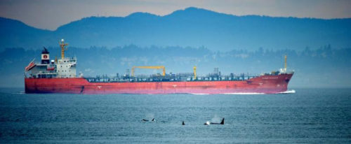
 The expansion of Kinder Morgan’s Trans Mountain Pipeline endangers our region. They are projected to nearly triple capacity of the existing pipeline from 300,000 to 890,000 barrels of tar sands crude oil a day – AND increase vessel traffic through the Salish Sea seven-fold, with each tanker holding more than twenty-five million gallons of oil.
Some of this product is slated for export through BP’s dock at Cherry Point. The Army Corps of Engineers is supposed to be evaluating the environmental impact of this dock, but it’s dragging its feet. We need you to speak up and tell the Corps to stop delaying and shine a light on BP’s dirty plans!
With a new administration set to control the Army Corps in less than two months, we’re running out of time to push the agency to act. The environmental study for the dock should reveal that the permit BP is using for this expansion was issued illegally and that their plans are dangerous. For more than 10 years, the Army Corps of Engineers has been delaying cracking down – now it’s time for them to act.
BP’s dock enables far more oil tanker traffic than permitted by a 1977 law written by Senator Warren Magnuson. And we’re not talking about just a few more trips than what is allowed – it would be at least 190 more tanker calls a year to the BP refinery. That’s a recipe for disaster in a fragile waterway already crisscrossed by thousands of ships bound to ports in Washington and British Columbia each year. These ships carry millions of tons of hazardous fuels and cargo. The U.S. and Canada do not have the technologies or capabilities to clean up a tar sands oil spill. In addition, advocates of the project have yet to even outline how to best equip first responders in the event of a spill.
Action from people like you recently helped push the Army Corps to halt the Dakota Access Pipeline. We know public pressure can convince the agency to do the right thing. Now, we need to build on that momentum and demand that the Corps of Engineers release the final environmental impact study for BP’s tanker dock.
P.S. While Friends is dedicated to preventing fossil fuel export from degrading the Salish Sea, we also need to be prepared for increased shipping so we can be proactive about protecting our San Juan Island waterways and Salish Sea from vessel traffic risks. We are currently working to protect our coasts and communities from the amplified threat of oil spill and associated damage; press for oil spill prevention; advocate for a clean energy future; achieve legal protections; improve habitat management; and reduce threats to vulnerable species. Click here to make a gift to the Safe Shipping program and our annual fund – all dollars received before the end of the year will be matched, up to $25,000. Thank you again for your support!
**If you are reading theOrcasonian for free, thank your fellow islanders. If you would like to support theOrcasonian CLICK HERE to set your modestly-priced, voluntary subscription. Otherwise, no worries; we’re happy to share with you.**


Fuzzy math. Using the numbers given in the article it would result in an increase of 2.96, not 7 times the number of tankers. I’ve heard and read these same exaggerated numbers thrown around by several people, maybe someone should check out the “facts” before just regurgitating this stuff. Isn’t a three fold increase enough?
If we were really concerned about our “region”, we should have been supporting, not opposing, the Keystone XL pipeline which would have moved Canadian syn-crude to connections with US refining capacity in Lousiana.
Isn’t this all about reducing the use of fossil fuel and thus CO2 emissions? If it is, say so.
Can anyone explain how a three fold increase in oil results in a seven fold increase in tankers? I keep hearing this, but it doesn’t add up.
Right on Tom.
When activists block pipelines such as Keystone, which when properly built and operated are the safest way to move hydrocarbons, the market will find an alternative transportation method whether it be on tankers or rail cars.
Another example of a foolish decision is the recent “hold” put on the Dakota pipeline by team Obama which forces the Bakken crude (which would have used this new pipeline pipeline), to continue to be transported in much more dangerous railcars.
Unless you want to go back to riding horses for transportation, using sailing ships for ferries, not fly anywhere and give up on most everything plastic, hydrocarbons are part of our life. They need to be moved and used wisely but they are necessary.
Sorry for my delayed response. I am still decompressing after spending almost three weeks in London. We are so fortunate to live in our peaceful islands.
I can explain the “math” about the projected increase in tankers. Currently, most of the TransMountain Pipeline Alberta Tar Sands crude oil is sent from Canada to the U.S. via the Puget Sound Pipeline to our local refineries. The resulting gasoline and other products are used in Washington State. Only one Tar Sands crude oil tanker per week travels from Burnaby, B.C. past our islands on its way to the Pacific Ocean. If the TransMountain Pipeline expansion occurs, then 34 oil tankers per month are projected carry Tar Sands diluted bitumen past our islands on their way to the Pacific Ocean. This would result in a seven-fold increase in oil tankers traversing Boundary Pass, which the U.S. Coast Guard has called the most hazardous commercial shipping route on the west coast of the U.S.
In an alternative scenario, the Puget Sound Pipeline from Sumas in B.C. to our local refineries could be expanded to carry the excess Tar Sands Diluted Bitumen to the British Petroleum docks at Cherry Point in Whatcom County, just 10 miles east of Orcas Island. This would allow Canadian Tar Sands crude to be exported from our U.S. coastline with few benefits to us and many risks. The risks include spills of diluted Tar Sands crude that have no known ways of “clean up” when spilled into marine or brackish waters. (The bitumen component of diluted bitumen tends to sink after the lighter diluent fraction evaporates.)
If we make the export of Canadian Tar Sands crude easier, then the increase in Tar Sands crude production will compete with the production of U.S. oil. The increased competition will drive the global price of crude oil downwards and hurt U.S. producers. Why would we want to favor Canadian jobs over U.S. jobs?
This issue is so extraordinarily complex.
If the Keystone Pipeline is not completed, allowing Bakken crude to be sent to the Chicago area, then that product will be shipped by train to Bellingham.
And that is only one piece of the puzzle. The Canadians will pipe or rail ship Alberta tar sands oil to Vancouver for shipment by tanker through the Salish Sea. We don’t control how the Canadians handle these products.
And then there is coal coming from Wyoming through our communities for shipment from Ferndale. I counted one train last year with 139 coal cars.
North Dakota is criss-crossed with over 1000 miles of buried pipelines, Google that and be shocked.
Until and unless some genius develops a practical alternative to the internal combustion engine, we are faced with a certain set of realities that are an integral part of our lifestyle.
And on top of all of these business realities, there are the political implications of buying oil from the Middle East as an alternative to being energy independent.
At this point in time, I prefer that the U.S. meets its own needs without having to deal with the other countries, and in the meantime make our transport of oil and coal as safe as possible with high-tech railcars, and pump stations while we work toward alternative energy systems that can eventually replace carbon fuels. I don’t expect to see the solution in my lifetime.
I still can not replicate the numbers provided by Friends of the San Juans (FOSJ) as regards increase in “vessel traffic” through the “Salish Sea”.
Seven months sago I asked FOSJ to provide the geographic boundaries of the “Salish Sea”, specifically for the latitude/longitude such that it could be plotted on a nautical chart, and FOSJ has been unable to do so. So I still have no idea where, specifically, the “Salish Sea” begins and ends, nor the area it entails. [as an aside, this was specifically in regards to the FOSJ idea of requesting a Particularly Sensitive Sea Area (PSSA) – something I have heard little about since].
As per the FOSJ note published in Orcas Issues (above), I followed the provided link to “…see a more detailed comment..”, and while the more detailed comment has citations, citation [1] is merely a link to material that no longer exists (or, the link is broken). Upshot is that I cannot review the Vessel Traffic Risk Assessment (or assessments) that FOSJ is basing their claims upon.
It’s nice that Janet Alderton provided some background to the FOSJ argument.
It sure would be helpful if FOSJ would tell us, the readers, what their sources are such that we can become informed on the issue.