
— by Margie Doyle —
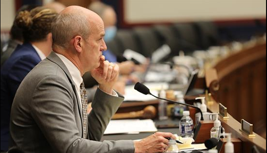
On Friday, Dec. 11, the County Council met in Eastsound for the deferred public hearing on the Eastsound Subarea Plan (ESAP) and decided to act on three of the five map amendments proposed in the update. The decision about two additional contested map amendments to the plan will be among the subjects of council discussion next week. The ordinance changing the Subarea Plan is scheduled for adoption on Tuesday, Dec. 15.
If the Subarea Plan, first adopted by county ordinance in 1980 is approved by the council, it will be incorporated into the County Uniform Development Code (UDC), thus allowing consideration of development changes in Eastsound without having to “queue up” in the council’s annual docket.
The Eastsound Subarea Plan update documents include:
- Minor amendments to the goals and policies of the plan and land use districts;
- Revised regulations concerning allowed and prohibited uses; and
- Amendments to the official map that include an extension of the Village Commercial district along the north side of Main Street west of Washington Federal bank (“The West Gate” entrance to Eastsound Village) [Exhibit 1]; the creation of a new residential district with a maximum density of 12 units per acre between Mountain View and Seaview Streets [Exhibit 2]; and repairing the split-zoned parcel at the corner of North Beach and Mount Baker Road [Exhibit 3]; and repairing another split-zoned parcel on Bartel Road [Exhibit 4].
After public testimony was closed at Friday’s meeting, the council voted on the Map Amendments described in Exhibit 2 and 4; they also voted to maintain the current restrictions on a Limited Commercial Area of the Eastsound Commercial zone that has come to light in the Map Amendment Process. The Limited Commercial Area is adjacent to the Orcas School District campus, on Madrona Street between Rose Street (the Orcas Public Library) and School Road. This area is within the Eastsound Village Commercial zone.
At the request of Council member Rick Hughes, Maycock advised where each of the four exhibits had originated.
Prior to voting, the public heard Maycock describe Exhibit 2 “Mt. View -Seaview residential” as an area encompassing 41 lots of which 5 are undeveloped. The change from Village Residential to Eastsound Residential originated with OPAL Land Trust. It doesn’t change the density allowed, but does affect the allowed uses, removing those that would be inconsistent with the Village Residential designation.
Exhibit 4 retained a split zone designation, but the majority of the property was changed from Eastsound Rural to Eastsound Rural Residential. (A small percentage of the property, within the Urban Growth Area (UGA) remains zoned Eastsound Residential with a density limit of 4 units per acre).
The density of the Eastsound Rural Residential zone remains the same (1 unit per 5 acres), but the changes would allow for development of rural residential clusters, which gives a housing bonus for affordable housing. Maycock said the amendment originated with a phone call from the public.
It has been disclosed that the property involved in Map Amendment Exhibit 4 is owned by Fred Klein, a member of the Eastsound Planning Review Committee.
Still to analyze are the two exhibits that have cause some discussion among the EPRC and the public attending the Subarea Plan meetings and hearings.
Exhibit 1: Rezoning the property fronting on Main Street just east of Washington Federal (“The Twin Towers”) from Village Residential/Institutional to Village Commercial.
The zoning change would result in a density change from 4 to 40 units per acre. The property under consideration has been built and operated with a conditional use permit, and the property owner requested the map amendment. Discussion has noted that the change would simply acknowledge the property’s actual use; but parking and traffic patterns in that zone has brought out concerns.
Patty Miller said that if the area were “rezoned to full commercial use, it would allow retail and restaurants,” that would add to road safety concerns, particularly in the summer when ferry traffic arrives at the “Westgate Entrance” to Eastsound. She also pointed out the difficult of putting in a in sidewalk on the north side of Main Street at that point. She suggested that the Council may want to consider rezoning to the property as “Village Commercial Limited,” as is operative along Madrona Street south of the school.
The second controversial area was shown in Exhibit 3, the split zoning on Orcas Port land, purchased with FAA funds, at the northwest corner of North Beach and Mount Baker Roads (“The Port Corner”).
The Port District had proposed that the split zone be made all Service Light Industrial (SLI); and not be split with the additional Eastsound Village Residential zoning, which allows 4 units per acre. SLI zoning allows for such uses as heavy equipment rental and parking. Port Manager Tony Simpson has said that the FAA aeronautical uses, but that a parking lot may be an option
Simpson also testified that he was told that when the FAA purchased the property, the County Prosecuting Attorney had advised the Port that the split zoning was a mapping error and could be rectified.
John Campbell directly countered that notion in his public testimony, saying that while “split zoning is certainly to be avoided wherever possible,” the original designation as split zoned was “the deliberate intention… as an urban design consideration.”
He recalled that a house was on the location when the Port bought the property and says the split zone was designated with an understanding of “the importance of protecting airport from residential development; the issue now appears to be the reverse.”
He also pointed out that the line between zones is a continuation of the line that already exists along North Beach Road. “The intention was to make North Beach Road an attractive thoroughfare; the incompatibilities are extreme between Eastsound Residential and Service Light Industrial. Restrictions on the lot’s use were “to prevent encroachment from the airport.”
EPRC Chair Greg Ayers said the county advisory committee’s “position is to leave it as it is and consider [in 2016] with the [update] of the Comprehensive Plan and look at other ways this may be managed; perhaps a change to Eastsound Village Institutional,” as proposed by John Campbell.
Maycock noted that the property was designated Service Light Industrial to help the airport in its development, and that zoning the entire parcel SLI “is in keeping with the goals and policies of the Eastsound Subarea Plan.”
Simpson drew attention to the fact that both county staff, the County Prosecutor and the Planning Commission recommended the split be “repaired” by making the property all SLI. Ayers added that the Planning Commission vote was not unanimous.
County Council member Rick Hughes said that while the EPRC was opposed to making the property all SLI, “they are interested in working with the Port on a good solutions that will alleviate the fears of the community while still meets the needs of the Port and the FAA.”
He asked to reopen the public hearing so that he might hear testimony from Port Manager Simpson. With the hearing re-opened, Simpson said that the FAA regards land purchased with FAA funds to be used specifically for aeronautical uses and “never allows for permanent compatible use.”
“The FAA asserts a prohibition on any park or recreational facility,” Simpson said, although the Port has maintained that the current Dog Park on the locations is not a park but a rental facility. He said that an aviation museum, plane maintenance and storage may all be considered aeronautical uses, and that a parking lot or airport access may also be future uses of the property.
The Council will resume public deliberations on the Eastsound Subarea Plan on Tuesday, Dec. 15 and hopes to pass the update ordinance that day.

**If you are reading theOrcasonian for free, thank your fellow islanders. If you would like to support theOrcasonian CLICK HERE to set your modestly-priced, voluntary subscription. Otherwise, no worries; we’re happy to share with you.**


It is amazing to watch the video today as Mr. Hughes makes unilateral changes to the Eastsound Subarea plan in the absence of any Eastsound residents being present. It is very sad that his changes were not discussed at EPRC meetings where Eastsound residents could attend. I am sorry I was unable to attend to provide input.