||| FROM SCOTT PATTEE for WA SNOW SURVEY OFFICE |||
SPOKANE VALLEY, Wash. – Following a very dry summer, water-year 2023 started off with extremely dry conditions. The last waning days of October brought much needed rain to the region. November continued the trend but remained warm preventing much snow accumulation until the end of the month. Authentic snowfall finally began statewide in early December, with it, brought normal pass and highway headaches. Another major wintery system hit the state just before the holidays, thwarting many holiday travel plans.
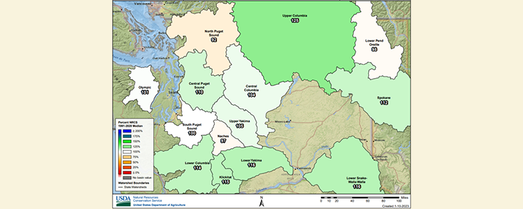
The most recent forecast through late-January shows a probability for above normal temperatures and above normal precipitation. NWS 3-month (Jan-Feb-Mar) forecast indicates below normal temperatures and above normal precipitation which is indicative of the forecasted Enso La Nina #3. The U.S. Drought Monitor indicates the continuation of D0, Abnormally Dry, for most of the state with a few pockets of D1, Moderate Drought. (see maps on page 4)
To read the full report, click here, to access reports dating back to 2010, click here. For further questions, please contact Scott via email at scott.pattee@usda.gov or phone at (360)488-4826.

**If you are reading theOrcasonian for free, thank your fellow islanders. If you would like to support theOrcasonian CLICK HERE to set your modestly-priced, voluntary subscription. Otherwise, no worries; we’re happy to share with you.**