
— by Matthew Gilbert, Orcas Issues reporter —
In this story, we begin with the ending: The fate of those trees on Orcas Road along the west side of the straightaway just south of the Exchange appears to have been pre-ordained.
After several conversations with representatives of Public Works, Councilman Rick Hughes, and Orcas resident Tim Blanchard (representing a group of Orcas Islanders – he also happens to be Chair of the County Planning Commission), it seems the trees were doomed once the County decided to widen that road as a safety precaution and as part of a larger grant-funded project that was approved more than six years ago and just recently implemented.
The official purpose of the project was to improve “1.1 miles of Orcas Road from just south of Nordstrom’s Lane to north of McNallie Lane. Safety enhancement included the addition of road shoulders, improved curves at the intersections, increased sight distance for the entire road length, bike shoulders, and stormwater improvements.”
There are still conflicting stories of what was said and discussed at a series of public meetings and workshops three years back. Councilman Hughes, who stated he “never wanted to lose this view corridor,” didn’t recall any pushback from constituents when he proposed a “do-nothing” alternative during those sessions. He also admitted that the County could have done a better job communicating the evolution of the project as it got closer to reality since revisions to the original plan were in constant motion. By the time the project went out for bid in late 2018, the specs were basically set. Skillings Connolly out of Lacey, WA, got the project; their harvesting and sale of all the trees along the “improvement zone” was a factor in their proposal.
The County has been upfront about its ongoing work via a series of newsletters and postings of docs on its website, but the flattening of the land along the straightaway south of the Transfer Station blindsided locals.
Concerns were raised that the trees to be cut were not clearly marked on any of the plans until the last minute. This appears to be true, but it’s also true that the County had little choice but to widen to the west since the strip of land to the east of the road had been secured by a conservation easement via the San Juan Preservation Trust in 2007; that right-of-way wasn’t available. [It took the County nearly two years to secure right-of-way access along the stretch of road south of McNallie to Nordstrom’s Lane.] As well, OPALCO had taken down some trees when it buried its lines, and the adjacent property owner had provided U-cut access for many months prior. In short, the area had already been compromised, but as Blanchard noted, “it was a shock. Had the community known of this ultimate outcome, there would at least have been time to grieve.” Hughes contends that the public process was extensive. “We did the best we could.”
An argument could be made that the final decisions could have been different had there been more imagination and all the variables and impacts fully discussed, but that’s in an alternate universe. As noted by County Engineer Colin Huntemer, the County did consider “all the options” and any choice would have been complicated. Other arguments have been more basic: Why widen the road at all? As Hughes emphasized more than once, it was a safety issue. The road has no shoulders, and there are line-of-sight issues. “Two 18-wheelers would have trouble passing each other on this road. What swayed my vote [the grant itself was approved prior to his election] was a firefighter on San Juan who said it was scary to drive it.”
A key issue for Blanchard is whether this will be the fate of all such roads on Orcas and elsewhere in the County. “What will be destroyed next based on whatever is approved?” For him (and others), the key is “a better process going forward – which is more difficult than it sounds – and incorporating concepts of the 1995 Scenic Roads Manual into county road standards,” yet another challenge. But according to Blanchard, it’s one that the County and the Planning Commission are willing to pursue.
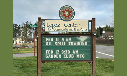
And contrary to some assumptions about the road’s ultimate build-out, there are as yet no plans for a bike path along it. “Off-road bike paths are not part of the scope of this project,” said Hughes, noting the sign at the intersection of Orcas Road and McNallie Lane directing bicyclists to detour east. Instead, he said, there are plans to use county properties such as Fowler’s Pond to create a network of connective bike paths.
In the end, Hughes emphasized patience and the commitment of the County to add a new “evergreen line” of canopy trees and plantings once the project is completed. “I want folks to have a little faith in the County, to trust in how nice the road will look when it’s finished, safer and, ultimately, just as beautiful.”

**If you are reading theOrcasonian for free, thank your fellow islanders. If you would like to support theOrcasonian CLICK HERE to set your modestly-priced, voluntary subscription. Otherwise, no worries; we’re happy to share with you.**


Nice smooth read, Matthew. Thanks.
As for content; we see once again how grants wag the dog. If you fund it, they will carnage. I have driven that road for thirty years without getting scarred and I’m no firefighter.
As Mr Blanchard put it, “What’s to keep other roads in San Juan County from meeting the same fate?” Excellent question. Or the airport, I might add.
Sure, Councilman Hughes, I would like to trust the County Gov, but apparently they are not masters of their own domain.
Mathew–Again, thanks for the hard work it takes to do a story like this, and for getting folks together to talk about it. Keep it up.
Joseph–Exactly. it is my understanding that our-then County Engineer built those excessive wide shoulders into the County’s grant application so when the money arrived, so did the obligation.
New rule: A bright red ribbon on any tree destined for the sawmill for six months before cutting.
Good point, Peg, one that I failed to note in the article. That engineer’s name was Rachel Dietzman, who apparently also secured a grant for “roadside clearing” that targeted everything within 10 feet of any road pavement. The money was spent on a GIS mapping system that identified all such “hazards.”
Thanks for bringing this to public attention, Matthew, for I’m sure a lot of islanders have been thinking about it. I, for one, was contemplating a Guest Opinion article, complete with photos, but you have obviated that necessity.
With all such expansions and “improvements,” serious care should be given to preserving the rural character of Orcas Island — why so many residents and visitors love this place. I now miss driving through that vale of old trees, which was always a pleasure on heading to the ferry or back.
“fait accompli”
Etymology: borrowed from French (“an accomplished fact”),
(plural faits accomplis); (colloquial American) a “done deal”.
Usage notes: Often said of something irreversible and/or completed before those affected by it are in a position to query or reverse it.
nice discussion
. IMHO important to note that there seem to be two countervailing forces in public works: on one side we need to have faith in our government to attend to the details of difficult technical decisions: Competency-
on the other we need to have access to those details and to the process of evaluating them: Transparency.
Sortof “Trust- worthy .. AND .. verify- able.”
When our trust is abused that faith necessary for normal operations goes away. This does not seem the case here, showing how hard it is even when good will and professionalism are apparent, but patterns of egregious governance raise the risk for ALL public works.
The point is NOT legal “did we follow the rules,” BUT em, moral “did we respect our neighbor’s trust” in our community. When this is abused it skyrockets transaction costs -to all- for a long time. Some public services can be crippled for decades.
just how vital IS your secret agenda?
Trust: the ultimate Public Work..
People need to understand that this is how ALL grant-funded projects operate; the money is given YEARS before the contract bids. So what does this mean for the public and how do we combat what we don’t know about til it’s too late? YEARS too late? Please, someone, provide an answer to this question or we will continue to see projects driven by state and federal grants – and when it comes to roads, this means a 20 feet wider right of way since their standards are much wider than county standards.
Please people – you’ve got to understand this. Maybe a grant-watch group? Also, we need to watch permits; permits are given before any work can be done. If no one is watching, it’s an automatic NEPA instead of a SEPA – what this means, environmentally, is that the permit WILL be granted because the project won’t need an EIS unless it’s a SEPA. sorry for the acronyms – an article needs to be written just on this – we can’t rely on the county or the port to tell us. We have to be steps ahead of them because by the time a “workshop” (or three) happens, it’s already too late – the funds have been given.
I apologize for posting again on this subject so soon, but upon reading the comments, when I saw Rachael Dietzman’s name I flinched. I was at the “workshop” about this project. They had the 6 yr plan and a bunch of us tried to talk to her abbout THIS project. She was saying the speed limit could then be increased once they did it and we kept saying, “we don’t WANT the curves straightened, we don’t WANT the speed limit increased.” You see for yourselves the result of our input. It seemed to be a done deal and why were we there, other than perhaps some legal obligation to avoid lawsuits?
I understand the concerns of bicyclists – more and more locals are using them for transportation, especially now that they can be powered by electric. And I agree that we have too many cars and not enough carpooling and public transit We cannot keep fighting like the Hatfields and McCoys on these issues – We need to come to some agreement about this or it’ll not only tear our ecosystems apart, it will tear our community apart. I love this place and the people here, but am more and more feeling like we have no representation here unless we want year-round tourism industry and gentrification – and we’ve said countless times and in countless ways – we DON’T.