
— by Matthew Gilbert, Orcas Issues Reporter, updated Sept. 25 at 9:30 p.m. —
After a tumultuous few months of public meetings and public outcry, the Port of Orcas presented its 20-year Master Plan at the Orcas Center on Wed. Sept. 19. And while a “No Change” alternative was technically one of the options, it became an empty lightning rod for citizen resistance to the Port’s ambitions. In its place is a three-phase development proposal that will change the face of north Orcas, depending on which elements are ultimately carried out.
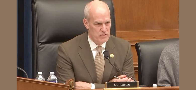
For those of you new to these deliberations, the short version is that the Port has been consistent in defending the need to make changes to meet mandated FAA safety requirements, while a large and vocal group of locals challenged that rationale on various grounds. Some felt that the tail was wagging the dog: hypothetical possibilities of what can go wrong (but haven’t in the many decades of the Port’s existence) were driving an entire re-working of the Port’s facilities. Nevertheless, the “No change” option floated by the Port turned out to have had “no chance” of ever being accepted, which added to the public’s frustration. In the end, as pointed out several times by Port Manager Tony Simpson during the previous weeks, it was never intended to be a democratic process and the Port essentially got its way.
At last week’s presentation, representatives from the consulting group DOWL made an effort to justify the decisions behind the plan they came up with and also explain how public opinion did in fact influence some of its components. As project lead Leah Henderson explained, it’s about “meeting future aviation needs and achieving FAA standards.” And because the Port has taken advantage of the FAA’s AIP grantmaking program to the tune of approximately $9 million, and because the FAA can legally demand (though apparently seldom does) that those monies be paid back if the Port falls out of compliance, decision-makers may have been feeling boxed in.
The numbers do show a steady increase in Port traffic over the next 20 years. Even at a modest yearly increase of 2 to 3 percent, overall “aircraft operations” are estimated to go from 42,340 in 2017 to 56,003 in 2037, a 32 percent increase, while commuter enplanements, defined as “boarding passengers,” will go from 9,180 to 15,948, a 74 percent jump. “Enplanements are generally flat across the rest of the country,” said Henderson. And as it stands, the Port is technically out of compliance with nearly every standard associated with an airport of this size and current use, from runway width to control of protection zones.
That all said, the devil is in the details, and the Plan’s three-phase development scenario allows for some pretty drastic changes, most of which are scheduled for the “Mid” and “Ultimate” Development phases which don’t begin until 2026. (An environmental review of the Plan will be required.) The most immediate “Short-Term” need is a widening of the runways, followed by infrastructure changes that include more hangars, more parking spots, and more tie downs. “Runway lengthening is not in the Plan,” emphasized Henderson, who added that the team was working with Brandt’s Landing to minimize impacts on the marina. But those widened runways could accommodate wing spans of 70+ feet compared to the 40+ feet that characterizes current use. As one local confided, “I’ve seen a DC-3 land here,” which can carry up to 30 passengers. That doesn’t mean the door is open given runway length and weight restrictions, but still . . .
In the medium term, the most contentious parts of the Plan have to do with development of the southeast parcel and placing the cargo facilities (e.g., Aeronautical Services) at the end of Seaview Street where the Port owns property and plans to add hangars. Regarding the former, Henderson noted that public input convinced the planners to add more trees along Mt. Baker Road, create a wider buffer zone, and potentially limit the number of hangars to be located there. (This is also where the new terminal will go and where passengers will load and unload.) Assurances were made that any changes would comply with the County Comprehensive Plan and the Eastsound Vision Plan. As for the relocation of the cargo facilities, projected traffic increases of three-to-four times current levels on Seaview drew plenty of pushback from audience members.
The biggest headline of Phase 3 (“Ultimate”) development is the relocation of Mt. Baker Road, which is in the Runway Protection Zone. Aviation Engineer Eric Strong of DOWL said that the depicted re-routing scenario was still just a “line on a map,” but when the consultants started talking about the possibility of turning MBR into a tunnel that runs under the Port’s property, one could feel the pitchforks coming off their hooks.
During the meeting of September 12, most of the commissioners essentially demurred on what they thought would actually happen. And there is a sense among some that the process was largely carried out to show the FAA that the Port was making a good faith effort to bring the runways and facilities up to standard (so as not to jeopardize AIP monies) and not as an opportunity to bake in a wish list of all possibilities. It’s difficult to know at this point and a lot can happen in twenty years. The ultimate question is what can be controlled for now.
Final public comments are being accepted through October 5. You can send them to Leah Henderson via orcasmasterplan@dowl.com, but given their focus on FAA compliance it’s also important to contact the Port directly at orcasairport@rockisland.com / 360-376-5285 or any of the commissioners:
- Shawn Simpson (shawn@portoforcas.com)
- Dwight Guss (dwight@portoforcas.com)
- Greg Sawyer (greg@portoforcas.com)
- William S. Hopkins (steve@portoforcas.com)
- Brian Ehrmantraut / Chair (brian@portoforcas.com)

**If you are reading theOrcasonian for free, thank your fellow islanders. If you would like to support theOrcasonian CLICK HERE to set your modestly-priced, voluntary subscription. Otherwise, no worries; we’re happy to share with you.**


Like the Haven Road sidewalk, the proposed airport expansion and “modernization” is opposed by most of the voters who are, and who will be, affected by it.
When a governmental or quasi-governmental body makes a decision to proceed with a plan with which its constituents strongly disagree, it is a result of Progressivist thinking: “We know what’s best for you, and you don’t.”
So think of Haven Road’s sidewalk, and what’s going to be done with our airport, when it comes time to elect county, state, and federal representatives. Do you really want to elect Progressives?
Personally, I don’t care what a person looks like, how old they are, whether they’re gender non-binary (just learned that one), male, female, of any political persuasion, identify themselves in ways other than saying they’re “human” (my preference), or what not.
I just wish they’d be logical, pragmatic (a bit less political), and truly make an effort to maintain what is as close to paradise (physically and communally) as is Orcas Island—it’s so much so more than any other place I’ve experienced traveling the world over.
To have such a rare combination of intelligent people along with such immense physical & pastoral beauty, Orcas Island should never to be taken for granted.
It seems some have been too isolated and may have forgotten what a relative paradise this place truly remains.
We should redouble our efforts to preserve it. Our is such a diverse and vibrant community that we should be able to intentionally direct how Orcas is managed, grown and protected.
Of all communities throughout the country who find themselves rudderless, Orcas Island is not one such community.
This excellent coverage of the Master Plan Issues and citizen involvement is so well reported and deserves our full attention. I hope we can keep focused on this article, and not get diverted by any off-topic assumptions.
In the FAA handbook and in DOWL’s presentation, when airports take AIP grant monies, they HAVE TO allow anything that can land and take off. Jets are not held to the same weight standards as prop planes.
Last week, a jet with at least 8-9 seats (double that, if there were two seats per row) climbed an almost vertical, impossible-looking ascent directly over Lavender Hollow’s North end, just over our firs and rooftop. There were witnesses and passerby; we were alarmed to see and hear this. It was LOUD (over quick) and frightening. The jet banked hard east without even bothering to go south beyond the 2nd building in our multi-building complex. I should have reported it. If this is a precursor of what’s to come, we’ll be impacted all directions from the runway – not just to the south.
We need a LOT more answers about what planes will be able to use this airport, once the runways are separated to 240′ to allow up to 79′ wingspans.
If this overblown monster-of-growth-and-development presented as DOWL’s and the Port’s Preferred Alternative, becomes our Master Plan, what happens in 10 years when we do another one? Where was/is Public taxpayer influence in this process? Should we be satisfied with the stock FAA-textbook answers given by those who stand most to profit by them? (FAA, Consultants, Port)
The FAA encourages Capital Improvement Plans for airports, directly tied to AIP grants and the annual discretionary monies they give. (Ours will jump to $1 million a year because we’ll get 10,000+ enplanements this year). Where are the on-the ground economic impact studies – plummeting real estate values, noise and other pollutions, traffic congestion, environmental destruction, ETC?
I appreciate the Port’s efforts to educate us, yet we remain unconvinced. I hope the Public will stay involved with this crucial issue, both short-term and for the long haul.
Mr Henigson, please give us your definition of a progressive. Are they somewhere between a Democrat or a Republican? Why do you capitalize progressive? In your opinion, are progressives good or bad people. Enlighten us please. Thank you.
A little levity; memory of the past:
In about 1970, my husband and I were traveling from southern Germany to Greece, by way of then Yugoslavia. We arrived very late in Athens, and groped our way to a “lodging” for the night. It happened to be a place to park our VW microbus, and sleep in the host’s yard It was pitch dark, but we found our way, and were told to park on the lawn next to the house. As it was a balmy night, I put my sleeping bag out next to the VW, and quickly fell asleep. Not long after that, I heard a sound, getting louder…and louder. Then, a light blasted in my face. It was a commercial jet coming in on a landing, just clearing the airport fence as it skimmed over me!
So, what to do? I fell asleep again, only to be woken again, and again by the landing planes. I did get enough energy to turn the sleeping bag away from the on-coming planes to avoid the search light in my face.
Sleep? No. The planes were intermittent, and the last one I actually got a photo of in the early morning light, as it filled the camera frame, maybe 100 ft above me. If I ever can find it in my hundreds of slides, I’ll prove it to you.
It was an interesting meeting put on by DOWL. One thing a DOWL person told me that I hadn’t known is that there is no way for FAA or Orcas Island, or anyone else, to restrict the size of plane coming into the airport….it is TOTALLY at pilot discretion! In other words, and this was a quote from the DOWL representative, “Yes, a pilot could try to land a 747 here if they thought they could do it.” I don’t know about you, but I think that is a little scary…and it impacts my thoughts about the airport in future. I’m pretty sure we elected the port commissioners…
I’m confused. A majority of the people didn’t want the sidewalk at Haven Road (think parking for Odd Fellows Hall), the propane tank thrust upon neighbors (think peace of mind), or the airport expansion (think less is more for a pleasant rural quality of life). Voting machines nationwide are privatized. How’s our Democracy doing?
The consultant talked about our future mega airport and terminal that would be so grand that it would be such a great place to spend some time there when coming to town and bring guests maybe they would serve kool
aid ! Maybe Big Bertha could be coming to Orcas to dig the tunnel ? An aircraft carrier could transport it here and we could have our Airport Manager standing on deck
This is a well-written article Matthew. Thank you for posting this.
Thanks for those comments, Sadie.
It appears initial concerns were perhaps understated.
One strategy might entail the community/public seeking a legal option to stall / slow the unacceptable Master Plan in order buy time til elections.
In the meantime explore how to subsequently cancel what might be passed in the interim with minimal negative impact on the community, replace it down the road with Alternative One to include maintenance of what now exists, and organize a campaign to elect those who will honor the island’s rural character come election time….
The Goal- maintain a rural airport that’s consistent with the island’s current and projected need.
The current airport maintained can meet projected need if we stymie the growth in needed air transportation on and off the island by not building the infrastructure permitting the increased traffic and larger craft.
Think of it like a Bonsai. Sculpt your own size that fits the community’s definition of quality.
Don’t think bigger is better, or that it’s inevitable. It’s not logical. Especially on an island that can’t grow in size!
Low-to-Medium income residents—school teachers, service sector support personnel, etc—won’t clamor for higher cost air transportation on and off the island. They don’t now; it’s not within their budgets.
The need for a larger airport is being manufactured the way technological innovation manufactures “need” tomorrow that you lived fine without yesterday—this is inevitably followed by getting hooked on “growth” for its own sake.
If you “don’t” build it, the rural destroying changes “won’t” come —because they can’t come…certainly not in the way they need to to do maximum damage via big $ development.
So, again, find a way to stop/stall the airport expansion and then elect people who will rep your priorities.
Just wanted to make sure that people understand that the most important time for influencing what the Port includes in the Master Plan, and the general locations for those items is by the October 5, 2018 comment deadline. In the first evening presentation last Wednesday the consultant stated that the FAA would approve the Layout Plan and THEN the draft report would be released for public review and comment in late 2018 or early 2019. In the Q&A and follow-up discussions that statement was described as a mistake and it was clarified that FAA approval of the Layout Plan would be very close to final but not actually final. However, the consultant also confirmed that significant changes at that later date of the draft report release would be highly unlikely and that changes would be for things like the correction of clear errors, not in the kind of planned developments or general locations for those developments. So- if you have comments, make sure you submit them by the October 5th deadline instead of waiting for the draft report.
In terms of public process it’s also important for the public to communicate their input directly with the Port Commissioners and the master plan committee members. The consultants have been hired to develop a plan that moves the Port towards full FAA compliance; as much of the public sentiment is actually questioning the need/value of that underlying premise, the most effective audience for those comments isn’t going to be the consultants.
@Chris Graham; you make excellent points. Workers and low income people have no real voice in this process. There is a whole capital improvement rollout presented by the FAA/DOWL that are income generators for the Port – it’s what the FAA and Consultants do – grow airports – ground dwellers be damned! The commissioners are unfortunately buying their ideas; why not build the maximum income producing footprint? Once it’s all in the Master Plan, the monies will come from FAA grants – exactly the people’s concern – and rightly so.
I don’t think our desires were understated; just ignored. I’m sure you read the articles and letters in O.I. the past several months.
No concessions were offered. We were told a MOD wouldn’t work – all manner of scare tactics were used to get the people to back off. We still said no, we don’t want all this in this master plan. On the 19th, people got to hear the hard truth that negates ALL the Port’s verbal assurances that bigger planes and more jets won’t come; if you build it, they can’t stop it!
You have made some suggestions, Chris; we welcome more from anyone who has them. Time is short. We’ll need a lot of people and effective action within 10 days – regarding the comments.
Great synopsis Matthew (left that out of my prior comment)
Are the commissioners hands tied? These are very likely fine, quality people. Who’s really driving the expansion? Could the commissioners stop it with their inherent powers if they wanted to?
Absent public opposition being able to alter the minds of the commissioners (or those behind them influencing matters), the obvious remaining recourse appears to be legal (unless another option that I’m not seeing remains).
When are elections?
Has anyone reached out to local counsel with a strong environmental / public interest / community streak from SJ County, or nearby on the mainland for a consultation?
Depending on the strategy and legal basis for objection (suit), this set of factors may implicate federal court jurisdiction and perhaps an injunction halting development subject to X, Y or Z.
Is there enough public concern and interest to mount a campaign? (Legal Fundraising)
Some ProBono services might be offered if there were enough public interest.
Do most of the residents in the community opposed to the Alternative to be pursued believe there’s no other way to alter its direction?
You likely have a network of friends who can land you a free legal consultation, yes?
Folks that are back and forth on Orcas Issues above…Please, Please, Please don’t get into a law suit with the port! I do not want any of my tax money that goes to the port to be spent on an argument with a vocal group opposed to the port plans! Instead continue to discuss with your elected officials who make the decisions! Don’t worry about this port manager being around for long, (you all can certainly send your applications in soon to be the port manager) I am certain that all of your attacks at him have him looking forward to stepping out of this job sooner than later. Just as we got rid of a fine Fire Chief in Kevin O’Brien we can soon get rid of a very sharp Tony Simpson. I am sure you all can attack me now, but I can’t let Tony continue to be hammered without someone standing up for him (really Pierrette? an Aircraft carrier?) Orcas Issues is getting out of control!
I hear you, Andrew.
And my inclination is to agree with you, too. I dont know Tony but I have a sense he’s a fine person from the exchanges we’ve had in this forum. None of this I hope has been personal.
In all sincerity, how do you suggest the community prevent what they clearly do not want to see happen with respect to the airport? Have they not tried something? Haven’t they already talked in good faith, shown up, taken surveys, and made clear their issues? No one wants legal entanglement but what’s the alternative,
realistically?
I would only clarify one thing repeated in this article that Tony is said to have said,
as follows:
“In the end, as pointed out several times by Port Manager Tony Simpson during the previous weeks, it was never intended to be a democratic process and the Port essentially got its way.”
To further refine Tony’s alleged statement …this IS a democratic process…the one we’ve had for over 200 years.
We vote followed by our representatives discharging their duties. That’s what is happening here. When you’re not happy with the representation, you vote differently next time; and if the next time is too far away to prevent what is seen as irreparable harm, you talk and talk and when that fails you look for other legal means, right?
Isn’t that how we do things in a democracy?
Or, we just give up, not spend our resources for that which matters most and remain passive as others direct in areas most important to your everyday life.
So, what are the alternatives in all sincerity?
ANDREW…”we got rid of Chief O’Brien”?
Seriously? How?
Chief O’Brien used Orcas as a stepping stone to greener pastures and left the fire commissioners holding a bag of crap by basically bolting without warning.
I’m surprised that you want to open that can of worms….
Still admire and respect you and all you do…I just don’t agree with this comment!
Peace…
My statement was that this was not a direct democracy or government by public opinion poll. The segment against any and all change has been organized and vocal, but that doesn’t mean it is either correct or the majority and, in the end, neither matters. Like almost all democracies in the United States, this is representative democracy or republic. Statements are made here that there is overwhelming opposition. The Madrona Voices survey provided a broader and more nuanced perspective than this forum or even the comments received directly. In the end, the commissioners have to act as they deem necessary and prudent for the Port and the Community. — Everyone eligible is welcome to run for election, but you will find that the State of Washington’s restrictions on recall petitions is very narrowly limited.
It’s probably wrong, but I do take it personally because nobody listens to what I say or if they listen, the don’t believe me. If you don’t believe me, you either think I don’t know what I’m talking about or you think I’m a liar. You may not call me ‘incompetent’ or a ‘liar,’ but effectively your actions and statements say the same thing.
Well I hope you don’t take anything said herein personally, Tony.
I certainly respect you and your position as I’m sure do others.
Yes, so we’re clear on the fact that we are a democracy and the process has been as much. There’s no need to refer to a direct democracy as I don’t think one exists anywhere, certainly not in our country.
I think the better way to see this is not as a wrong
or right position. Rather, it’s which alternative either better reflects the rural character of the island, or doesn’t. The Port’s preferred alternative isn’t “wrong” in as much it doesn’t fit the island’s rural character, according to most who have opined . That’s all.
Clearly, the Port disagrees with the idea of keeping the airport at a size and type that comports with a small rural and rustic island; an island that doesn’t want to be identified with a fancy state-of-the-art
airport? Would you say that’s a fair statement?
Can you acknowledge that many in the community are simply stating the above in their many colorful ways but that this has nothing to do with personalities, or the people involved.
It’s simply a different vision of how the community sees the island now and tomorrow, and how an expanded airport beyond what we need or want conflicts with this view of a “rural” Orcas.
That’s a legitimate beef? Right?
What might anger and upset many is that so few people are willing to override the clear majority who oppose the Port’s preferred plan.
The community has one simple question?
For whom do you do this?
Can you tell us what majority on the island supports your preferred plan?
Why would you proceed with your Plan if Alternative 1 is the overwhelmingly preferred choice?
Can you understand how this might come across as a feeling of betrayal— by the community?
Perhaps the City of Chicago (Mayor Daley) has the answer. When he wanted the land used by the airport on the waterfront for other purposes, he simply tore it up one night and the FAA let him get away with it for a mere $33,000 fine. If people on Orcas don’t want what the FAA does the precedent is there to take matters into your own hands.
Check out: https://www.cleveland.com/metro/index.ssf/2014/03/burke_lakefront_airport_meigs.html
Chris–I’ve literally answered all of your questions before, in emails, in private and in public.
For whom do you do this? – Pilots, Passengers and People on the ground. Their safety and service.
Why would you proceed with your Plan if Alternative 1 is the overwhelmingly preferred choice? = Because Alternative 1 threatens the Port with Bankruptcy and the eventual elimination of this airport.
Can you understand how this might come across as a feeling of betrayal— by the community? No, because most of this will not happen in my lifetime. Rebuild the runway (no real change). Move the terminal (serves the traveling public better and facilitate improved safety). Mt Baker Rd…unlikely to happen for all the constraints cited. Brandts-Ditto.
I would feel betrayed if the Port took action that would jeopardize this airport, potentially incur financial liability in excess of $9M and significantly imperil the existence of the airport without significant tax increases. That would be a betrayal.
Rural character being threatened? Not even 10,000 people by planes – several hundred thousand by ferry, along with their cars.
We don’t have the clout of Chicago or a second airport.
Thanks, Tony.
The sense I’m getting from those who spoke to DOWL is that it would be difficult to keep a lid on more dramatic future changes once we entered the “B2 and beyond” airport world, and the items you remove above from risk of happening isn’t something you can really guarantee not to happen. That’s probably the practical fear of starting down this road. While there’s no need to demonize the large infusion of funding the Port would receive (all airports need adequate funding), the concern here may be that we’re “chasing the money” and molding the airport however’s necessary to ensure its receipt—the tail wagging dog idea. And doing this despite the inherent conflicts the Port’s preferred plan has with EPRC and County vision statements (that are also shared by the local community’s idea of what “rural” means).
And also that the future challenges the airport would face remaining “as is” (alternative 1 with maintenance & upkeep) are perhaps being dramatized (due to the above monetary carrots as opposed to safety), and could be addressed by less life-changing means (life-changing for the community and the airport). After all, the airport hasn’t had a significant accident (recorded) in the decades since it began operations, right?
But, again, thank you Tony for taking time to respond.
At least it’s pretty clear where the differences and emphases of each side lie.
Mr. Jehly, you can find a good definition of “Progressive” in the Wikipedia article found at: >https://en.wikipedia.org/wiki/Progressivism<
Note that Manifest Destiny, and its attendant control or elimination of America's native peoples, was an original feature of the Progressivist Movement. I'm happy that that seems to have changed. Somewhat.
I would like to echo Andrews fine comment, and say the comments directed at our port commissioners is really unnecessarily and really a disgrace. Not everyone on the island is opposed to the port expansion, so let’s make that clear. We should be thanking the commissioners for keeping the airport safe and operational for everyone to use, and for coming up with a plan for the future. Infrastructure is important to keeping our island current with the times we live in. The days of moving here, and closing the door and throwing away the key are over!
Jon- i think that boat sailed a while ago and the insanity of growth for growth’s sake (and not based on actual need) is why many have moved here from the mainland.
There is a movement in society to reassess the profit driven model that has placed humanity on an ecological and societal knife edge. That reassessment is what you’ve been witnessing here in this forum.
What you claim as keeping us “current with the times” to many is the broken mainland model that’s literally breaking the planet.
All I’m request is that you place these matters into a more accurate, broader perspective. We don’t live in a vacuum; transferring mainland infrastructure to a small island is the very recipe that I would venture to say a clear majority on the island oppose and do not want to bake.
Why don’t we conduct a non-binding referendum island-wide on the airport’s alternative options?
I would like to see a clear unambiguous statement of precisely what is required to maintain minimum standards w.r.t. the FAA’s safety requirements. I.e., a proposal shorn of all the non-essential components whether that is includes extra hangers, relocated terminal, relocated freight handling facilities, etc..
Furthermore, is there actually a precedent for the FAA asking for “its” money back or is this just “it could happen (though) never does”. If so, please cite.
For those of us in the crowd that are really having trouble with the process here and trying to wrap our heads around it I’d like to lay this out in a way that’s understandable for me and see if this is about right:
-Port’s required to update its Master Plan.
-FAA requires Port to identify known issues.
-FAA requires Port to develop plans that will address said issues.
-Plans must address issues but need not be fully vetted for complete viability.
-FAA can withhold/reclaim money if adopted plans don’t address compliance issues.
-A “non-action” item must be included by design in the planning process to reflect the baseline.
-Adoption of the Non-Action places the Port as a taxing district at risk.
-Port Commissioners direct their manager to work through the process and it’s web of governmental requirements.
-Port Commissioners (elected by the taxpayers) weigh the cost/benefit in their fiduciary capacity to the Port and make a decision on a proposal that, while unpopular, they believe is in the best interest of the Port given it’s mandate.
-Port Manager and Port Commissioners are berated for making a decision.
Am I close?
Thanks to Tony and the Port of Orcas Commissioners for working through a very difficult, but required process. There’s a bunch of us out there that trust your judgement and are just really glad that we are not sitting in your chairs.
Justin- all reasonable people can appreciate your comments. I certainly do. Of course, most would say.
But as reasonable adults, we also know the devil’s in the details and in the interpretation of what’s actually “necessary.”
Is the Port’s preferred plan the only viable option given:
-the accident-free history of the airport;
-the work-arounds suggested by knowledgable commentators to remedy the issues of safety while retaining MBR’s present configuration and the airport’s long-term “rural” strategy; and
-the strong preference by residents not to take the airport into the direction reflected in the Port’s preferred plan but instead to satisfying the FAA through an alternate route (e.g., Alternative 1 or a Modified version of Alternative 1).
There’s a valid concern about the direction unleashed by embarking down the Port’s preferred road–and not just as to the immediate impact it will have on the locals in its initial stages. This is a genuine, good faith concern.
It’s reasonable, therefore, that voters look to the fiduciary obligations of all involved in questioning the “need” for a more expansive, complex airport (this is a major undertaking).
So, we’re all wondering why not dedicate the energy and very wise and capable talent of Tony and those running the Port towards a “less is more” work-around to satisfy the FAA’s requirements “at the least invasive level.”
It’s not unusual for an elected body to return to the voters for confirmation (whether by its own volition or due to legal obligation) when undertaking a substantial, material alteration to a community’s base blue-print affecting its major infrastructure. I think many thought that what was happening. What happened? The community responded so substantially and fully.
If it would help, let’s have an island-wide referendum to confirm the level of opposition.
Ken–you make excellent points. This is the very information we have been seeking. What is truly required? If the airport is noncompliant now, why is it open? What is our exposure for recapture of prior grants, and why did the Port commit to comply with the (in my view, somewhat arbitrary) FAA demands every time it sought grants from them? We are a tiny, low-volume airport, with a great safety record, not Paine Field.
Thanks, @Neil Kaye; I’ll grab my pickaxe! …(WTF?!)
OK; now I’m angry. This coverage by Matthew Gilbert was exemplary – let’s not waste it. To correct some of the many misperceptions and misleading comments posted so far:
1) The 4 DOWL Alternative 1 was No BUILD – not “No Change.” The airport already has sufficinent lands to make many changes. (library front desk has June and Sept Plan drawings). We support UPS getting a new facility and a terminal expansion if necessary. So, don’t paint us as “lock the island and throw away the key” people if you haven’t been involved in the meetings and don’t understand what’s going on.
2) The tone of our comments has been questioning, concerned, and challenging toward the lack of transparency, and the polar-opposite EXTREME Preferred Plan that was put before us publicly on Sept 19 by DOWL. In a Publicly-owned port, we have this right. There have been a few cringe-worthy comments on both “sides”; to focus on only those, disrespects the legitimate concerns of hundreds of people.
3) Regarding MOS (MODification of standards), did we even TRY applying for it with the FAA, considering that we have sufficient land, water, and high density constraints? What happened to the 156′ separation? Why push for the most extreme buildout possible?
4) The reason we chose NO BUILD (besides thinking that DOWL put it out as a fair option; what a sham!) was to slow down decisions this important and have the Port listen to us – what we got is extreme dictatorship. Please fix this!
5) I don’t think Tony Simpson is inept or a liar; I’m sad that he takes it all personally. I want the words “slow down” and “compromise” to mean something. I certainly DO NOT want the Port Commissioners recalled – I have been trying to build relationships with them, and with Tony.
So let’s cut the crap and snark, and get to work to effect something more responsive to both sides of this thing NOW, while there’s time. Tony talks about the nuanced picture Madrona Voices paints in their Master Plan survey; shouldn’t the solutions also be nuanced?
That’s gettin’ to it, Sadie. Well said.
As Sadie implores, let’s find a solution.
Good people all, good minds all means we can find a fair solution.
> -Port’s required to update its Master Plan.
Understood.
> -FAA requires Port to identify known issues.
What “issues” are mandated (per the FAA) as safety related and which are not? For those which are safety related what are the minimum steps required to address them? A question which has been asked multiple times and not so far as I am aware ever clearly answered.
> -FAA requires Port to develop plans that will address said issues.
Again, which issues MUST the Port address (to keep in the FAA’s good graces) and which are, for want of a better term, lifestyle issues?
> -Plans must address issues but need not be fully vetted for complete viability.
I am not even clear what this means.
> -FAA can withhold/reclaim money if adopted plans don’t address compliance issues.
Provide a statement by the FAA (or other relevant authority) to that fact, or cite and instance where this has occurred. Otherwise it may as well be “beware the bogeyman”.
> -A “non-action” item must be included by design in the planning process to reflect the baseline.
If the Commissioners or the Manager knew ahead of time that the Non-action option was unacceptable then they should in all honesty indicated that it was not in fact an option.
> -Adoption of the Non-Action places the Port as a taxing district at risk.
Says who? Where is the statement/document/regulation which poses this threat?
> -Port Commissioners direct their manager to work through the process and it’s web of governmental requirements.
Understood.
> -Port Commissioners (elected by the taxpayers) weigh the cost/benefit in their fiduciary capacity to the Port and make a decision on a proposal that, while unpopular, they believe is in the best interest of the Port given it’s mandate.
The Port is not an isolated entity: it is a component of the the larger Orcas community. To mandate changes which do not take into consideration what is good and desirable for that larger community is the height of hubris.
> -Port Manager and Port Commissioners are berated for making a decision.
The PM and PCs have come under fire for not offering a “minimal impact” option since, as we have now been told, what many thought was that option was never going to happen. Furthermore, we have heard time and again that “we could owe the FAA millions of dollars”, or “we’ll lose our taxing district”, or “service providers will go away”, all without a shred of evidence.
Clarifications: As Sadie pointed out, Alternative 1 was indeed “No Build,” not “No Change.” For some reason the latter got stuck in my head and I apologize for misleading readers.
As for the FAA demanding payback for previous monies under conditions of noncompliance, my parenthetical (“though apparently seldom does”) is not backed by hard evidence. That was my impression but in fact this may not be actually true. Again, my apologies.
Matthew–is there hard evidence showing that the FAA has indeed sought return of grant funds from an ordinary rural airport? I’d appreciate hearing one way or the other. Thanks.
@Matthew – I meant no criticism of your great journalism. Alternative 1 “No Build” may mean the same as “no change;” I’m probably splitting hairs.
I read to pg. 85 of the 175 pages of comments so far. The overwhelming majority of commenters reject enlarging the Port’s footprint (AKA expansion). Why does there “have to be” a no-action item in plan alternatives, if it’s just for show? Wouldn’t it be more honest to call it “existing conditions” and show what minimum safety requirements the Port could make on its own land without acquiring more?
DOWL & the P.M. would be wise to consider the strong sentiment iof the many comments against ultimate buildout, and make modifications. That would have helped us make more effective comment with our preference, such as: “Expand the terminal in its existing location. Don’t include customs and border control capabilities at the terminal; FH already has that.” and, “Don’t apply for International (air)port status.” I plan to include those and many more specific inputs in my next comment(s).
Accusations were made that some people made “multiple” comments. As with any Public comment process, you may make as many different comments as you wish to support your input. Most of the “repeats” were either duplicate scans with more text added from the same comment, or repeats of the same date/ same comment. We’ll need that fixed.
I emailed Leah for clarification on a few things regarding comments:
1) Comments are due BY midnight on October 5th.
2) the complete list of all comments up to the October 5 due date will appear on the Port’s website in mid-October. There will be no more updates until then. (The last comment submission included was on 8/20.)
If you don’t see your comment from the previous comment period, re-submit it with the date sent previously, so it can be added to the document in proper sequential order.
I did not take it as a criticism, Sadie, but “no build” is potentially quite different than “no change,” depending on your definitions.
As for Peg’s interest in FAA repayment policies, I’m pretty sure “it’s complicated,” which Leah of DOWL essentially said (but did not dwell on). I would direct that question to her/them as well as the commissioners and the airport manager.