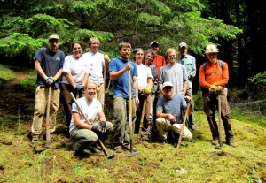
The Lost Oak Trail on Turtleback is now open, thanks to the efforts of Land Bank staff and volunteers (from left: Thom Pence and Allen Rosenberg, volunteers from San Juan Island, Jesse Douglas-Saltz, Nick Hershenow, Doug McCutchen and Ruthie Dougherty, Land Bank Staff and Washington Conservation Corp volunteers from Bellingham.)
Southside Loop for Turtleback Hikers
Over the last several months, San Juan County Land Bank staff, volunteers and members of the Washington Conservation Corps completed a new section of trail on the south side of Turtleback Mountain Preserve.
At just under ¾ mile, the Lost Oak Trail connects to the existing South Trail, allowing hikers the opportunity to make a circuit that includes Ship Peak Overlook as the highest point. “The new trail gives hikers the option to make a loop, or connect with the Ridge Trail,” explains the Land Bank’s Orcas Preserve Steward, Ruthie Dougherty. “More importantly, the trail helps tell another story of the mountain as it meanders through transitional forest, small meadows, and rock outcrops. The remains of an old fence line and silvered trunks of long-fallen oak trees are clues to the dynamic cultural and natural history contained within this landscape.”
With an elevation gain of 530 feet, the Lost Oak Trail is moderately strenuous, but the effort is rewarded with framed views to the west and shaded forest meanders. This addition brings the total miles of trail in the Turtleback Mountain Preserve to just under seven.
Lost Oak is a Pedestrian Only trail. Hikers are reminded to stay on designated trails, always leash dogs, and “leave no trace” when visiting Land Bank preserve lands.
**If you are reading theOrcasonian for free, thank your fellow islanders. If you would like to support theOrcasonian CLICK HERE to set your modestly-priced, voluntary subscription. Otherwise, no worries; we’re happy to share with you.**


Thanks to the Land Bank and volunteers for making it happen. I look forward to the experience.
Thank you. Thank you THANK YOU!!!